Imagine a world where every package, vehicle, and delivery arrives exactly when and where it’s expected. A world where supply chains operate with seamless efficiency, anticipating challenges before they arise. This isn’t a futuristic fantasy; it’s the tangible reality being built by advanced GPS and geolocation in logistics software. For too long, logistics operations grappled with visibility gaps, inefficient routes, and reactive problem-solving. Today, these powerful technologies are transforming the landscape, moving beyond simple “dot-on-a-map” tracking to enable precision mapping, predictive intelligence, and ultimately, unparalleled operational efficiency and customer satisfaction.
This article will delve into how modern logistics software with GPS tracking and geolocation capabilities are revolutionizing the industry. We’ll explore the foundational technologies, unveil their multifaceted benefits, examine their evolution into predictive tools, highlight essential features, and showcase real-world success stories. If you’re looking to enhance real-time visibility, optimize delivery routes, and unlock the full potential of your supply chain, understanding these innovations is your crucial next step.
How GPS and Geolocation Power Modern Supply Chains
To understand their transformative power, let’s first clarify the core technologies that underpin modern logistics tracking solutions:
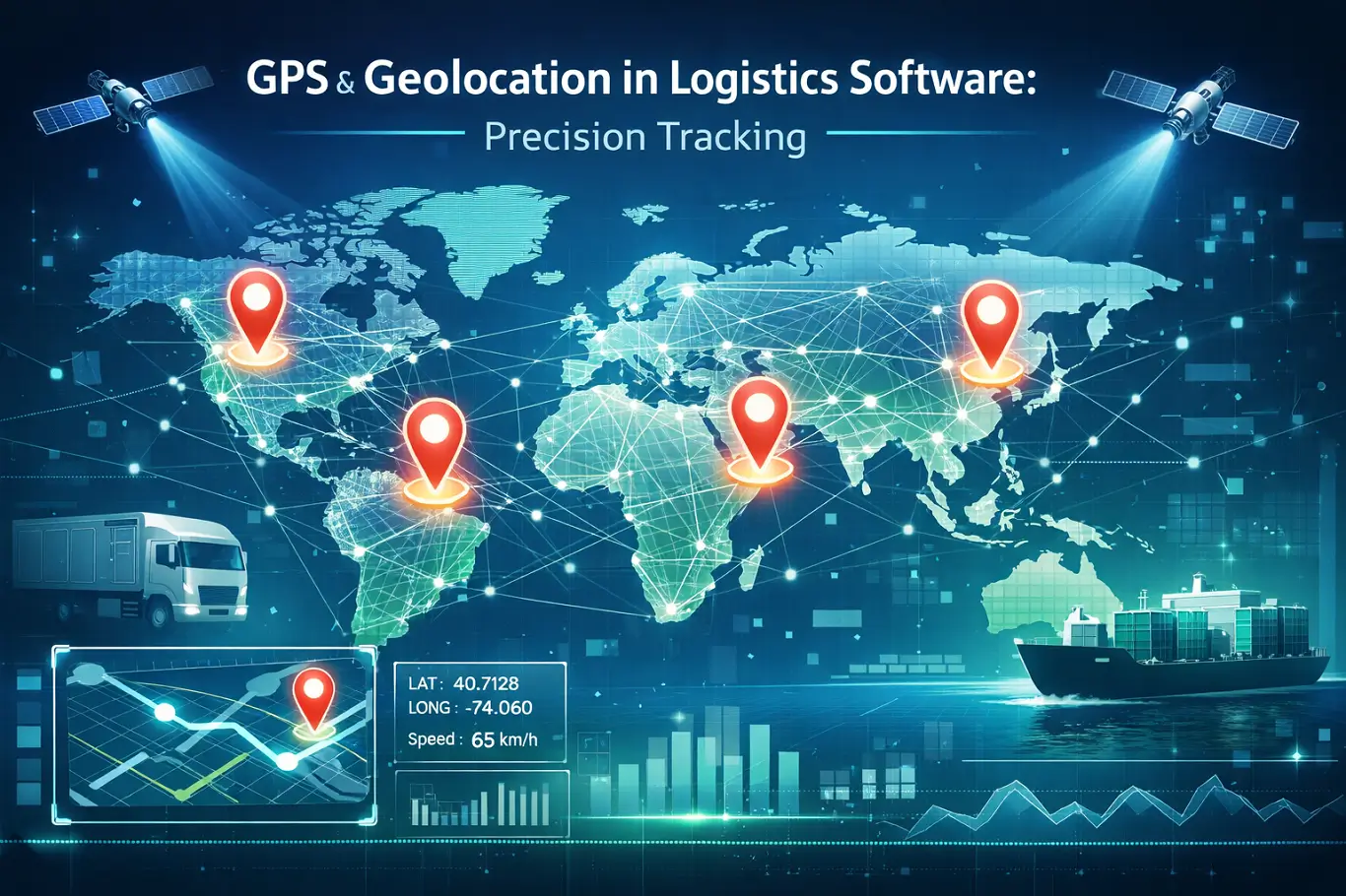
- GPS (Global Positioning System): Originally developed by the U.S. military, GPS is a satellite-based navigation system. It works by receiving signals from a constellation of orbiting satellites. Your GPS receiver (found in smartphones, vehicle trackers, or specialized devices) calculates its precise outdoor location – latitude, longitude, and altitude – by measuring the time it takes for signals from multiple satellites to arrive. This trilateration process makes GPS the bedrock of accurate fleet tracking solutions and asset monitoring.
- Geolocation: This is a broader term for identifying a physical location using any available technology. While GPS is a primary component, geolocation can also leverage Wi-Fi signals, cellular network towers, IP addresses, and even Bluetooth beacons for indoor positioning. In logistics, geolocation provides crucial context – understanding not just where an asset is, but its proximity to landmarks, depots, specific zones, or even its exact spot within a warehouse.
The synergy of GPS for pinpoint outdoor accuracy and other geolocation methods for contextual or indoor awareness creates the robust logistics mapping software essential for today’s comprehensive supply chain visibility.
Key Benefits of GPS & Geolocation for Logistics Operations
Integrating GPS tracking for logistics software extends far beyond simply showing a vehicle’s location. It unlocks a suite of benefits that directly impact efficiency, security, cost-effectiveness, and customer satisfaction.
- Enhanced Real-Time Visibility & Transparency:
- Gain instant, precise insight into the location of every asset—from trucks on highways to containers at ports.
- Improve supply chain visibility for all stakeholders, including dispatchers, suppliers, and end-customers. If you’re wondering How to Achieve Real-Time Visibility with Custom Logistics Software?, this technology is a core component.
- Result: Significant reduction in “lost in transit” issues and improved operational awareness.
- Optimized Route Planning & Dynamic Rerouting:
- Delivery route optimization software uses advanced algorithms to calculate the most efficient paths based on factors like distance, travel time, live traffic, weather, and delivery windows.
- Enable real-time adjustments for unforeseen events (e.g., accidents, road closures), minimizing delays and fuel waste.
- Impact: Potential for 10-25% fuel cost savings and notable reductions in delivery times.
- Superior Security & Asset Protection:
- Geofencing: Set virtual boundaries around key locations (depots, customer sites, restricted areas). Receive instant alerts for unauthorized entry or exit.
- Deter theft and significantly increase the chances of rapid asset recovery, protecting valuable investments.
- Ensure compliance by monitoring asset movement within designated zones (e.g., avoiding residential areas with hazardous cargo).
- Improved Fleet Management & Driver Safety:
- Driver Behavior Monitoring: Track speeding, harsh braking, rapid acceleration, and excessive idling to identify areas for driver coaching.
- ELD Compliance: Fulfill regulatory requirements for Electronic Logging Devices (ELDs), which rely on GPS to record Hours of Service (HOS), enhancing safety and reducing fatigue-related incidents.
- Preventative Maintenance: Accurately track mileage and engine hours to automate maintenance scheduling, extending vehicle lifespan and reducing breakdowns.
- Elevated Customer Experience:
- Provide highly accurate Estimated Times of Arrival (ETAs), allowing for proactive customer communication regarding deliveries or potential delays.
- Increase transparency and reliability, fostering trust and loyalty.
- Outcome: Directly translates to higher customer satisfaction and repeat business in a competitive market.
How Geolocation Fuels Advanced Logistics Intelligence
The true power of GPS and geolocation in logistics software emerges as it evolves from reactive tracking to proactive, predictive intelligence. This advanced capability is driven by aggregating vast amounts of location data, combined with sophisticated analytics, artificial intelligence (AI), and machine learning (ML).
- Data Aggregation & Analytics for Strategic Insight:
- Continuously collect historical location data (routes, speeds, stop durations, delivery patterns).
- Process and analyze this data to identify trends, benchmark performance, and pinpoint operational inefficiencies.
- Benefit: Enables data-driven strategic decisions and continuous process improvement.
- Predictive Analytics for Demand & Capacity Management:
- Leverage historical GPS data, alongside factors like seasonal demand, weather, and economic indicators, to accurately forecast delivery times and potential delays.
- Optimize vehicle and driver allocation based on anticipated demand peaks and troughs, preventing costly under- or over-utilization.
- Proactively manage risks by identifying high-risk routes or areas based on historical incident data, allowing for dynamic adjustments to plans in response to anticipated adverse events (e.g., severe weather).
- Seamless Integration with IoT and AI/ML:
- IoT Sensor Integration: Combine precise location data with real-time information from IoT sensors onboard vehicles or shipments. For instance, in cold chain logistics, GPS tracks the vehicle’s journey while temperature sensors monitor cargo integrity. Deviations trigger immediate alerts and pre-programmed responses.
- AI/ML for Optimization: AI and ML algorithms continuously learn from this rich dataset to improve. They can dynamically re-optimize routes in milliseconds, predict equipment failures based on usage patterns, and even inform automated systems for tasks like warehouse slotting or autonomous vehicle dispatch. This synergy creates a truly intelligent, self-optimizing logistics network.
What to Look for in Modern GPS Logistics Software
Selecting the right logistics software with GPS is a critical investment. Look for solutions that offer these key features to drive efficiency and insight:
- Intuitive Dashboards & Interactive Maps: A user-friendly interface providing an at-a-glance overview of your entire fleet or active shipments. Maps should be interactive, allowing for zoom, pan, and layering of data like traffic, weather, and points of interest.
- Customizable Alerts & Notifications: The ability to set up specific alerts for events such as geofence breaches, speeding, excessive idling, harsh driving, or significant ETA deviations, delivered via SMS, email, or in-app notifications.
- Robust Reporting & Analytics Tools: Comprehensive reports on key metrics like fuel consumption, mileage, driver performance, historical route efficiency, and HOS compliance. Advanced analytics should identify trends and areas for continuous improvement.
- Seamless Integration Capabilities: The software must integrate effortlessly with your existing systems, including Transportation Management Systems (TMS), Warehouse Management Systems (WMS), Enterprise Resource Planning (ERP), and Customer Relationship Management (CRM) tools, creating a unified data ecosystem.
- Mobile Accessibility: Dedicated mobile applications for drivers, dispatchers, and managers, enabling on-the-go access to real-time information, communication, and task management.
- Advanced Features: Look for functionalities like geo-stamped Proof of Delivery (POD), two-way communication tools with drivers, and specialized IoT sensor integration (e.g., for temperature, door status) relevant to your specific cargo needs.
Challenges and Future Trends for Geolocation in Logistics
While the benefits are profound, implementing advanced geolocation tracking logistics solutions comes with considerations and challenges:
- Challenges:
- Data Privacy & Security: Protecting sensitive location data from unauthorized access is paramount. Robust cybersecurity and compliance with regulations like GDPR and CCPA are essential.
- Integration Complexities: Connecting new GPS-enabled software with existing legacy systems can be challenging, requiring careful planning and potentially significant IT resources. This is where professional logistics software development services can make a significant difference, ensuring seamless integration and tailored solutions.
- Initial Investment & ROI Justification: The upfront cost of advanced systems requires a clear business case and accurate return on investment calculation.
- Data Overload & Analysis: Turning vast amounts of raw data into actionable insights demands skilled analysts or intelligent software capable of advanced visualization and interpretation.
- Driver Acceptance & Training: Overcoming initial resistance to monitoring technologies from drivers is crucial. Effective communication, comprehensive training, and demonstrating the benefits (e.g., safer routes, reduced stress) are key to successful adoption.
- Future Trends: The evolution of geolocation in logistics is accelerating, promising even more innovative capabilities:
- Hyper-Accurate Positioning: Technologies like Real-Time Kinematic (RTK) and Ultra-Wideband (UWB) will offer centimeter-level accuracy, even indoors, revolutionizing warehouse navigation and autonomous handling.
- Drones & Autonomous Vehicles: Geolocation will form the absolute backbone for the navigation, coordination, and safety of autonomous delivery vehicles and drones, enabling hyper-efficient last-mile solutions.
- Blockchain Integration: Combining geolocation data with blockchain technology can create an unalterable, transparent record of a shipment’s journey, enhancing trust and accountability across complex supply chains.
- Augmented Reality (AR): AR, powered by precise location data, could guide warehouse workers to specific items, overlay package information, or assist in vehicle maintenance, enhancing human-computer interaction in logistics.
- Sustainability Focus: Advanced optimization algorithms, driven by geolocation data, will further reduce fuel consumption and carbon emissions, making logistics greener and more environmentally responsible.
Final Thoughts
The age of manual tracking and guesswork in logistics is rapidly fading. GPS and geolocation in logistics software are not merely tools; they are the intelligent eyes and brains of the modern supply chain, enabling a fundamental shift from reactive problem-solving to proactive, predictive management. By embracing these technologies, businesses can unlock unparalleled precision, optimize every facet of their operations, significantly reduce costs, and deliver an exceptional experience to their customers.
The path to an intelligent, self-optimizing supply chain is paved with accurate data and smart location technology. Don’t be left behind in the logistics revolution. Explore how integrating advanced GPS and geolocation into your logistics software can transform your operations today! Contact us for a personalized consultation.
FAQs (Frequently Asked Questions)
GPS tracking offers numerous benefits, including real-time visibility of assets, optimized route planning, enhanced security through geofencing, improved fleet management and driver safety, and better customer service via accurate ETAs and proactive communication.
GPS specifically refers to the Global Positioning System, providing precise outdoor location via satellites. Geolocation is a broader term encompassing any technology used to determine a location, including GPS, Wi-Fi, cellular networks, and indoor positioning systems, offering more comprehensive contextual awareness in diverse environments.
Absolutely. Geolocation significantly improves last-mile delivery by enabling highly accurate route optimization, real-time tracking for precise ETAs, dynamic rerouting around obstacles, and enhanced communication with customers, leading to faster, more efficient, and satisfying deliveries.
While GPS tracking enhances asset security (e.g., theft prevention/recovery), it also raises data privacy concerns regarding sensitive location information. Robust cybersecurity measures, data encryption, and adherence to privacy regulations are essential to protect this data.
GPS is highly accurate for tracking vehicles and large assets outdoors. For inventory within a warehouse, dedicated indoor positioning systems (like UWB or RFID-based RTLS) often provide superior accuracy, though geolocation can offer broad zone-based tracking.